File:Nbcc ca mobi map-SJ-04.png
From Ideaspace Wiki
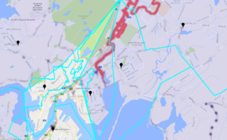
Revision as of 09:29, 15 April 2017 by Bill.mciver (talk | contribs) (Map 4. Fire stations, fire service zones, and evacuation routes superimposed on flood plains in Saint John, New Brunswick. We used this for the Open Data Visualization project.)

Size of this preview: 800 × 493 pixels. Other resolutions: 320 × 197 pixels | 1,451 × 894 pixels.
Original file (1,451 × 894 pixels, file size: 824 KB, MIME type: image/png)
Map 4. Fire stations, fire service zones, and evacuation routes superimposed on flood plains in Saint John, New Brunswick. We used this for the Open Data Visualization project.
File history
Click on a date/time to view the file as it appeared at that time.
| Date/Time | Thumbnail | Dimensions | User | Comment | |
|---|---|---|---|---|---|
| current | 09:29, 15 April 2017 | | 1,451 × 894 (824 KB) | Bill.mciver (talk | contribs) | Map 4. Fire stations, fire service zones, and evacuation routes superimposed on flood plains in Saint John, New Brunswick. We used this for the Open Data Visualization project. |
- You cannot overwrite this file.
File usage
The following page links to this file: